It was Monday, August 25th, and the weather was blustery and dark with powerful wind gusts that climbed the bluffs and pounded our car. Even the short 50 meter walk to breakfast was a fight against mother nature, but we needed the fuel for a long drive from Drangenes to Akureyri during which we’d cover a third of Iceland’s width.
NECROPANTS
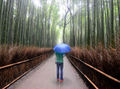
We decided to stop in Hólmavík to visit the Icelandic Museum of Sorcery and Witchcraft. (On a somewhat related side note, Angela read that 50 percent of Icelanders still believe in elves.) The museum was managed by a gentleman who presented himself in a bit of an elflike manner – his hat was woolen with runes on it, pointed and flared at the bottom like an ancient Viking helmet. He asked where we were from and jotted it down carefully, “San Francisco, U.S.A.” He then placed four pins in the giant world map behind the counter, gave us instructions for the museum and let us loose.
The museum was a dud. There were a few unusual things to see, but the presentation quality would be best described as campy. There were carved bones, raven claws, stuffed foxes and rats and other small mammals. And despite the assumed gender bias that “gross and bizarre = fun for boys,” both Asher and Ronan were bored. The only interesting piece was a pair of pants made from human skin ominously called the “necropants.” They were coated in glued-on hair (yes, even pubic) and featured cured genitalia. The necropants were supposed to bring good fortune to their wearer, provided they followed the rules of acquisition and usage: first, you had to get permission from the donor to dig up his body and cut off his lower half (I imagine this might have been difficult to get). Second, put a single coin into the empty and dried scrotum along with some combination of blood from a certain finger, a raven’s blood taken while it was still alive and a dried raven’s heart. Third, never remove the original coin from the scrotum – new coins would magically appear in the sack and those were okay to use. Finally, and most importantly, you must transfer the pants to another relative before you died or the good fortune would be lost. Pretty reasonable, right?
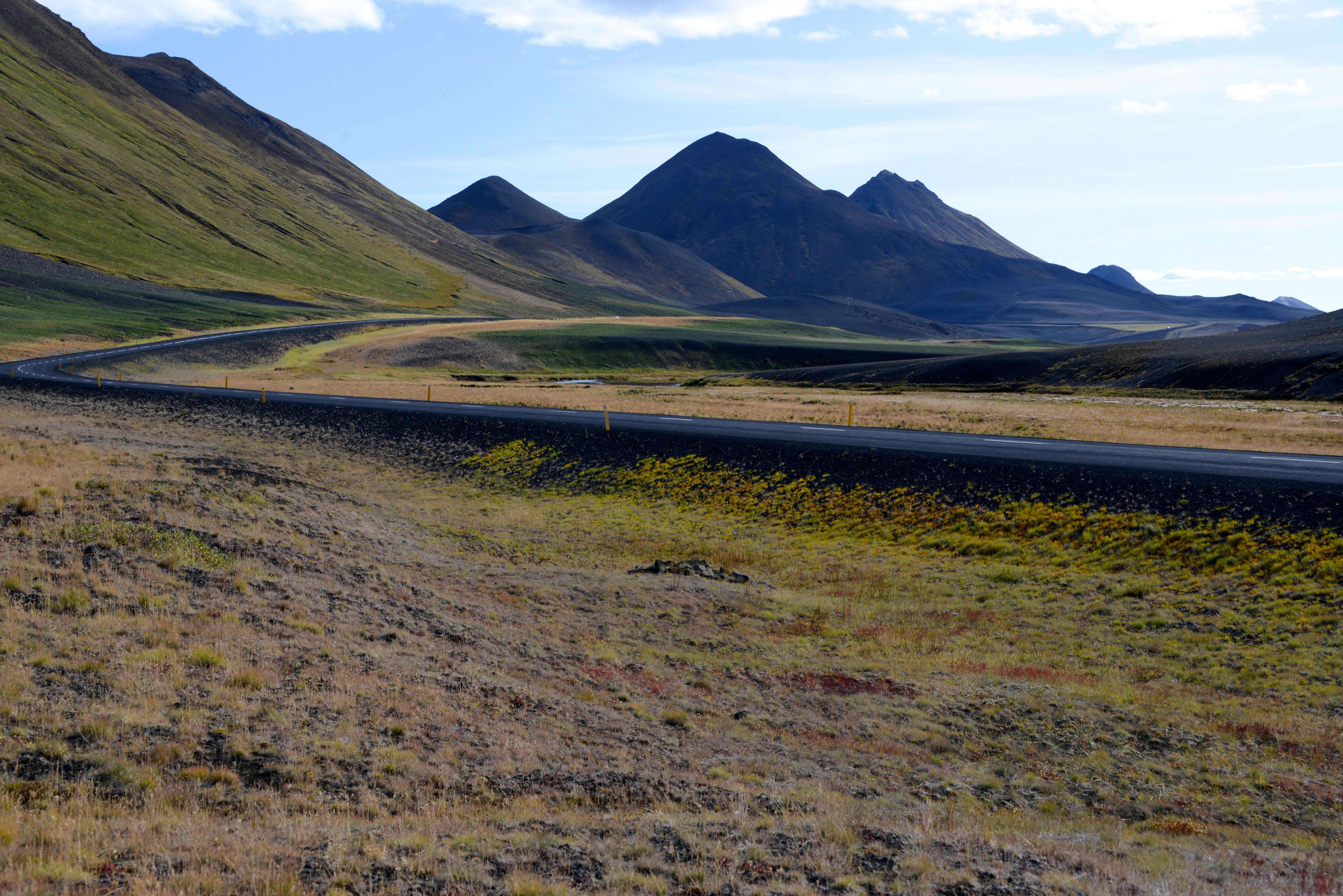
Driving in Iceland isn’t nearly as complicated as their legends. The roads are clean and well-maintained (when paved) and other drivers are generally polite and respectful. However, very few people use their turn signals, so tailgating is unwise. Luckily there are so few drivers on the road (Angela once counted that we passed two other cars in an hour) that tailgating isn’t much of an issue either.
CAPITAL OF NORTH ICELAND
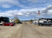
One of the highlights of our afternoon drive through small farming towns was a pass over the high heath, across snow-fed lakes and down through a steep glacial valley leading into Akureyri. Nicknamed the Capital of North Iceland, Akureryi is Iceland’s second largest city, with a population of around 18,000. It has the vibe, youthfulness and energy of a ski town. It also feels very safe and has an extremely low crime rate, which is important in a city with only five police officers only available on-call.
Our apartment was right in the heart of the town overlooking the square below. We walked to a music store to buy a power adapter for our computers, and the store owner gave me one from the computer he’d just bought. Free.
Dinner at a local Italian joint was salads, pizzas and calzones. We resisted the urge to try the horse (joking) but noted it was the most expensive item on the menu. For dessert we went to a local ice cream shop for shakes and cones. They sell a product in Iceland that looks like a Slushie but is called “Krap,” which was highly amusing to the boys. Krap means slush in Icelandic, by the way.
A DAY OF REFLECTION AT THE HALFWAY POINT
On Tuesday, August 26th we were midway around the great circle of Iceland and paused to catch our breath. Honestly, we’d been hustling hard since we arrived and had covered about 900 miles of fairly strenuous driving across dirt roads, through mountain passes, past sheep and swans and down narrow village streets.
Although the Myvatn was close by and offered some amazing sites – bubbling mud pots, geysers, and volcano hikes – we decided a day off was more important. The crew felt like we’d seen quite a bit of sub-surface volcanism in Yellowstone and Lassen, and although Akureyri itself is a gem of a city, we stayed inside our comfortable apartment. The boys were excited to be at “home,” but it wasn’t all fun as we held school sessions for both – grammar, art, reading comprehension, and Latin. Our one excursion was to the local Bonus grocery store to pick up items for lunches on the road. And dinner was Domino’s pizza – hooray! We just couldn’t handle another night of traditional Icelandic fare (and weren’t alone in that sentiment, as Domino’s was filled with English-speaking tourists). The day wrapped with the boys finding the UK version of “Wipeout!” on TV.
We’re sorry, Akureyri. We know there’s a lot more to your lovely town, but you caught us on an off day.
LINE OF SIGHT TO THE ARCTIC CIRCLE
August 27th was one of the longest drive days of the trip, taking us from Akureyri to Neskaupstaður on east coast, with many sites along the way. Immediately outside of town we headed for Goðafoss, a famous and much-photographed waterfall. We stayed just long enough snap a few photos and admire Mother Nature’s work.
From there, the northern route (versus east toward Mývatn) took us past many sheep farms and little villages including the town of Húsavík, famous for its whale watching. We soon reached the most northern point of our time in Iceland, which is also the most northern point we’ve ever touched on earth – north latitude of 66 degrees, 15 minutes. We stopped at a little gift shop/museum and looked across the horizon toward the imaginary line of the Arctic Circle. The island of Grimsey, which is split in two by that imaginary line, was visible when we stopped but then disappeared in the sea fog. I estimated that we were about 24 km from the Circle.
BÁRÐARBUNGA CHANGES OUR ROUTE
We headed south and paused briefly at a high overlook of the Öxarfjörður, and it was here that the current volcanic activities started to impact our travel. Our plan was to drive into Ásbyrgi Canyon then visit the western side of Dettifoss, the largest waterfall in Europe. But safety concerns by the Icleandic Meteorological Office (Met Office) regarding the magma moving beneath the enormous glacier prompted them to close some nearby roads and evacuate residents. This part of the country is in the relative low lands, so any eruption could cause massive flash floods.
With the western side of Dettifoss closed, we visited Ásbyrgi Canyon, which ironically was created by a massive flood of the Jökulsá á Fjöllum river, Iceland’s second longest. However, according to legend, the canyon might have been formed by the hoof print of Sleipnir, Odin’s eight-legged stallion, as he briefly touched the earth. Scientists can only speculate.
Ásbyrgi is a flat, birch- and willow-forested area bound on three sides by reddish-black crags over 100m tall. The horseshoe-shaped canyon has a large rock island called Eyjan (“the island”) that rises 25 meters in the middle of the valley. Never averse to introducing non-indigenous plants, Icelanders brought in larch, fir and pine to transform the valley into a beautiful walled garden of sorts.
As we headed south the road continued to rise on the Ódáðahraun, a vast lava field through which Jökulsá á Fjöllum cuts. The road conditions were awful, with potholes and slick stretches of soft ash that made traveling slow. But even more dangerous was the parking area for Selfoss, the first of our next two waterfalls.
I ran up a 15% grade, single-track road with a blind summit carved through a chunk of lava. If we met another car on the way up, one of us would have to back out of a difficult spot. Like other places we’ve visited (Argentina, Thailand), Iceland has few barriers or safeguards and even less legal language at their view points and trail heads – it’s up to visitors to take care of themselves. We played it safe and viewed Selfoss from a distance. On the way out, we watched a car back down from the blind summit, sliding and skidding close enough to scrape his car on the rocks.
Dettifoss is the most powerful waterfall in Europe and is about as dangerous-looking as anyplace we’ve ever visited. You can walk all the way up to the very edge of the 150 foot, massive-volume waterfall where the water is is opaque, gray, and grinding a path through the rocks. If you’ve seen the movie “Prometheus,” Dettifoss was featured as primordial earth. There are no barriers, safety precautions nor measures to prevent someone slipping into the river and over the cliff. We kept the boys back a great distance while Angela and I took turns going a bit closer to experience the falls. We saw one guy sitting on the edge of the cliff just downstream of the falls’ edge with his legs dangling over the abyss, not at all worried about how he was playing the odds.
CROSSING LAVALANDS
Back in the car, we drove across the great lava plains past cinder cones and basaltic outcropings until we found a picnic spot. As with so many days in Iceland, the weather evolved rapidly while we ate. Sunny and warm turned to windy and cloudy to rain and dark and back to sunny again. A long powerful gust of wind pummeled the car park for about one minute, then disappeared.
Thinking of the Bárðarbunga volcano, we looked for signs of danger off in the distance but nothing developed. Eventually, we came to and circled the town of Egilsstaðir before pushing out to the eastern fjords. We passed through two more towns – Reyðarfjörður and Eskifjörður (home to an enormous aluminum smelting facility), before climbing over the broad-backed mountain pass to Neskaupstaður.
At the top of the pass, the road entered a single-lane mountain tunnel about 7km long. There were infrequent pullouts along that path to let oncoming traffic slip by you, or vice versa, but the road is heavily traveled by large semi-tractors too long to fit into the turnouts. We crossed our fingers that we wouldn’t encounter any other vehicles and if so, then at least the driver would have remembered to turn on his headlights. We’ve never been so happy to emerge from a tunnel.
As we descended into the Nordfjardara valley and village of Neskaupstaður, we pulled out briefly to take a photo. Angela opened the door and stepped out but seconds later returned and slammed the door shut. With her came a most horrible smell of hot roadkill-spoiled beef-rancid fish. It was a heavy malodorous introduction to our destination for the evening, and our hope was that the smell was limited to the outskirts of the town.
It wasn’t.
You’ll get used to it, I said to the boys.
They didn’t (nor did I).
Our accommodation was an extended-stay apartment with two bedrooms, a living room, balcony, kitchen and bathroom. The TV was large and new. The wi-fi was Silicon Valley fast. Minus the town’s smell, it was too bad we were only staying one night.
AURORA BOREALIS
Because 99% of Iceland’s water is geothermally heated and since the nation endures long, cold winters, many towns have robust athletic centers with warm swimming pools. This town’s pool was next door, and with just an hour until closing time, we went over for a brief soak before dinner. Later that night back at our room there was an urgent-sounding knock on the door. I could hear someone standing outside, in the dark, breathing heavily. “Yes?” I said. “Sir, excuse me for interrupting your evening, but you should go out onto your balcony right now.”” Who is it?” I said, but couldn’t hear his response. Ready for anything, I opened the door cautiously and the owner of the hotel was standing there – panting and smiling. “Sir,” he said. “You should go out onto your balcony. It’s the Northern Lights. They are alive tonight.”
Outside, we stood looking up into the cold, crisp air, watching the greenish cloud dance and twirl in the sky above.
CLICK ANY IMAGE TO OPEN THE GALLERY.