We were lost, wandering the desert wilderness for about 45 minutes just north of Tsumeb (soo-meb). Worry was setting in. No map. No food. Only a quarter tank of gas in a country with very few filling stations. We had a couple of half-empty bottles of water and about four pieces of Werther’s candy for sustenance. I thought we were back on track, but the GPS system informed us in a starchy tone that we were 197km from our destination, after which Angela looked at me in alarm.
So trusting of electronic navigation tools like Garmin, Tom Tom and Google, we hadn’t purchased an old-fashioned road atlas. But technology was failing us at the moment; GPS had led us astray and, judging by the location of the sun, in the opposite direction. Until that point, we’d settled into a comfortable groove. The boys read their books and listened to music while Angela and I found solace in the beautifully bleak landscape of salt, sand and sunburnt scrub. I mistakenly believed we were one left turn away from our bush camp on the edge of Namibia’s famed Etosha National Park, but was clearly wrong.
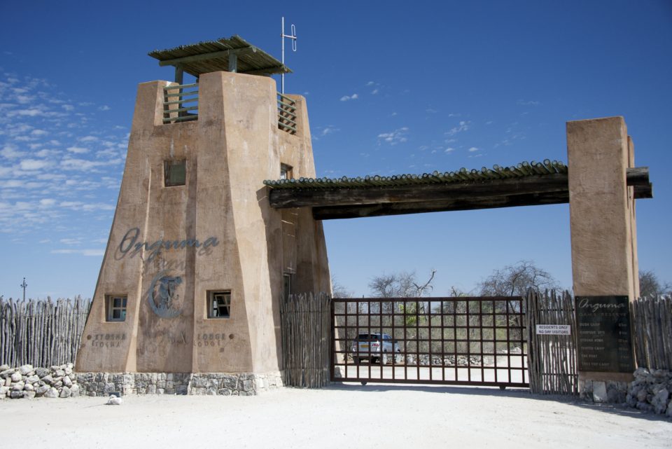
By the way, 197km at an average speed of 50kph meant we’d arrive long after sunset. We pulled to the side of the road, made an educated guess, and pushed forward on gut instinct, sharpened by 18 months of life on the road. After 90 minutes of ripping across washboard roads we finally found the promised land guarded by a Jurassic Park-sized, game-proof gate and a smiling guard.
DECIPHERING ROAD CODES
Several days prior, we first arrived via South African Air from Cape Town into Windhoek (vint-huuk), the capital of Namibia. Passport control was mostly routine – only a questionnaire regarding Ebola was added to the usual process. I got Namibian dollars while Angela picked up our rental car and the boys slumped in chairs, already exhausted from a long day. The lot manager spent an extra twenty minutes showing me in detail how to jack up the car and change the tires, an early indication that the procedure might be too frequently required. Unfortunately, this realization was slow to penetrate my very tired brain and I had to ask him for the rundown twice.
Once on our way, it took only a couple of miles to realize that the tires were over-inflated for the soft, lumpy asphalt road that ran from the airport into central Windhoek. Since I was unsure of the frequency of filling stations and air pumps, I chose to fight the car as it bounced and shimmied past the red rocks and blackened scrubland. As long as we stayed on paved roads, the extra air in the tires shouldn’t be a problem. Along the way there were many signs warning of impala crossings. Some of the game fences, ten-foot tale electrified barriers, had been knocked down by undeterred elephants or dug under by warthogs. Nature always wins.
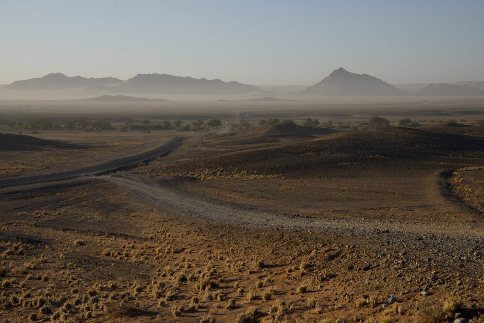
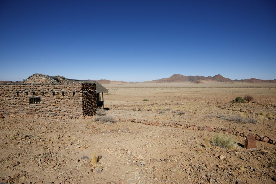
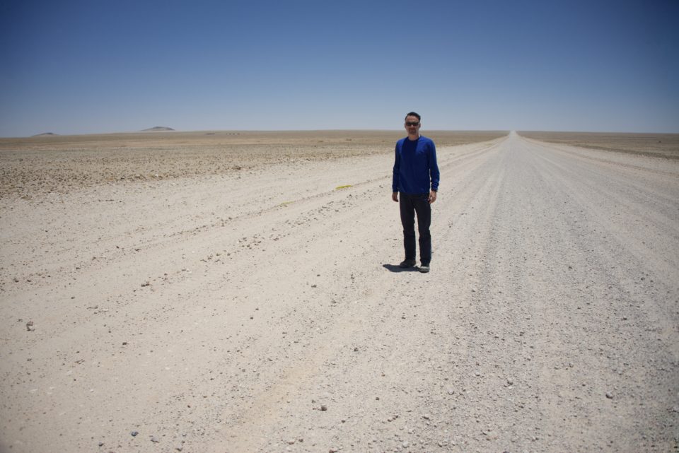
Our prim-voiced GPS guided us through Windhoek and out toward Namib-Naukluft National Park. There is a saying in Namibia that all roads pass through Solitaire, which was on the way to our destination, an outpost near Sesriem. Yet, mysteriously, the Garmin steered us along the path less chosen; in fact, as we came to learn, the path never chosen. A tip for future travelers to Namibia: use roads with A, B or C followed by one or two digits. For example, A1 or C14 is good. D1261 is bad. We spent nearly two and a half hours on D1261, a narrow, uneven and rocky road that seemed to be maintained no more than once per year. Along the way we crossed road washouts and passed through ghost towns. The corrugated road surface in combination with melon-sized rocks down the center made the drive exceptionally slow and hot work.
Most of the land we passed was fenced. Despite the scarcity of scrub or grass, this was herding country. Upon rounding a broad curve or cresting a ridge we might see cattle scattered in the shaded hollows of striated mesas or bustling among velvety grasses. We also spotted ostrich and admired the regal oryx off in the distance. Occasionally, a desert hare would bolt across the road ahead, and we gaped at the giant straw cocoons made by sociable weavers nesting in the spreading branches of acacia trees.
D1261 and D1275 were awful roads. I should have blown a tire or chipped a windshield, but didn’t. Whether good luck or faith, I didn’t care. We arrived safely at our camp just in time for dinner.
DRIVING ACROSS ‘ARRAKIS’
It’s better to batch pain, so we committed to a desert safari into the Namib-Naukluft National Park starting at 4:00a the next morning. Unlike our safaris in Simbavati Game Reserve, this wasn’t as much to see flora or fauna, although there is a surprising abundance of life in such an arid region, but to explore the park’s massive sand dunes. The largest game park in Africa, Namib-Naukluft also includes the Namib desert, the oldest desert in the world.
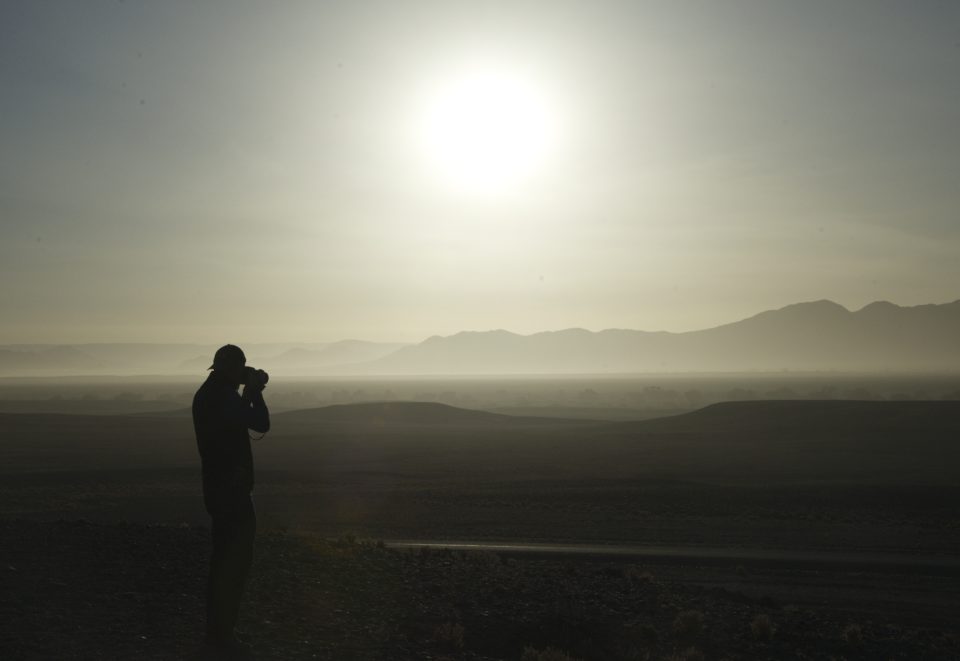
The Namibian desert is incredibly serene. There are no planes flying overhead, no road noise bouncing over the barren plains, no moisture in the air to cloud the stars at night. At four in the morning we had no trouble seeing the universe spread above our heads. Only the distant sound of jackals announcing a kill echoed across the vlei.
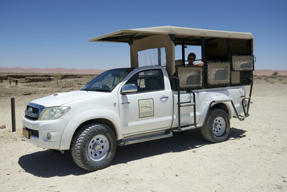
The truck was a re-purposed Toyota Hilux with a mounted bed insert to accommodate nine passengers in theater seating. It was open air with a stretched canvas top and despite being in the desert where it would eventually reach 100 degrees in the afternoon, we started from a very cool 60 degrees that morning. It dropped even further as we neared the entrance to the national park, where a wall of cool fog filled the valley. Even with blankets from our driver we shivered our way through the journey.
From the Sesriem gate our eventual destination was Sossusvlei (dead-end marsh), where we’d have brunch as the air started to warm. Along the way, we saw mountain zebra, kudu, oryx and ostrich, and we learned that there are five types of sand dunes. The dunes in Namib-Naukluft are star dunes, which means they have been formed by winds coming from multiple directions over the past several million years.
SKELETONS IN THE DESERT
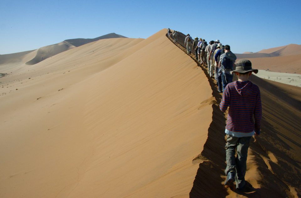
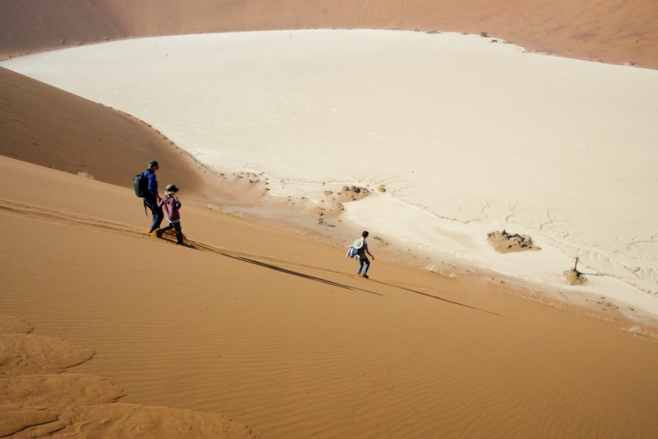
At Big Daddy, a 350m high dune overlooking Deadvlei (one of the most famous places in Namibia), we stopped and ventured out to climb one of those star limbs.
The dune was massive and the line of hikers stomping up the ridgeline ahead of us nearly disappeared in the haze between sand and sky. To reach the summit would have taken another three hours and we were hungry, so we bounded down the southern face of Big Daddy toward the cracked white-clay pan below. We probably looked like astronauts on Mars – high-stepped leaps into the soft red sand. Asher gripped my hand and we serpentined to provide some semblance of control over gravity.
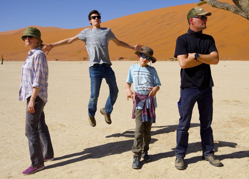
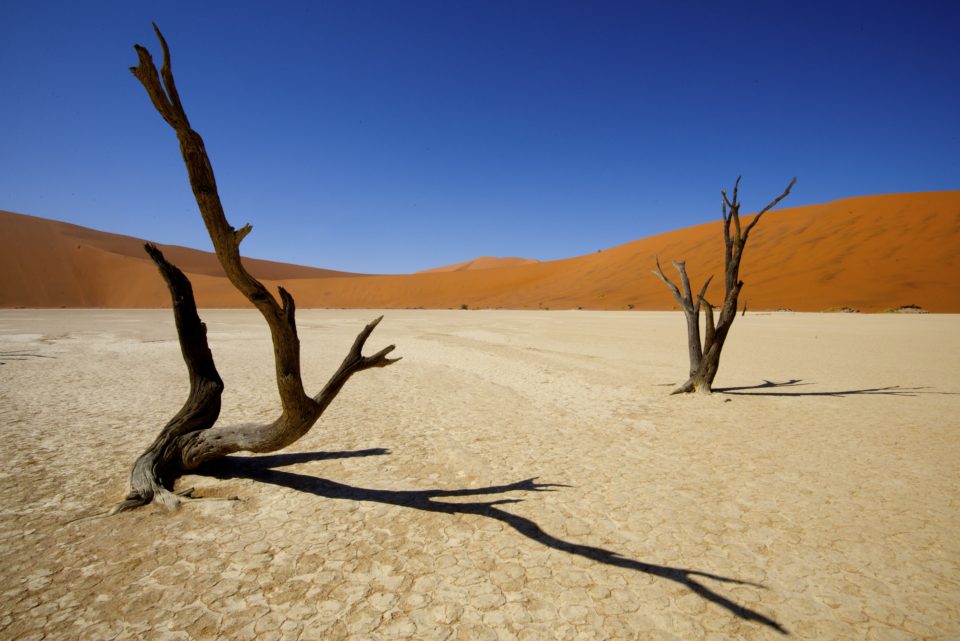
The base of the dune was Deadvlei, a place famous for its austere, otherworldly beauty. About 600 years ago, ephemeral waters that flowed into the marsh during the rainy season were stopped when the river cut a new course. The acacia trees that had filled this basin died, and because there isn’t enough water to rot the wood, they still stand – blackened by the unforgiving sun. The combination of deep ochre sands, light gray pan, black acacia skeletons and the brilliant azure sky made the vlei one of the most naturally photogenic places we’ve visited.
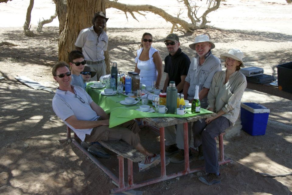
We could have spent another hour in the bowl, but our fellow safari-mates were ready to go. And our guide wanted to secure a prime spot beneath the cooling branches of a tree near Sossusvlei for brunch. By 11:00a, it was nearing 95 degrees.
We had a good guide for the day. The guy really knew how to handle driving in sand. He made only two errors in the scripted parts of his presentation. The first was calling the vegetation on the sides of the dunes vegetarians – “if you look at the sides of Big Mama, you can see vegetarians holding it in place.” The second was in calling Sesriem Canyon the second largest in the world. Sesriem Canyon is a 3km long gash in the desert about 6m wide and 30m deep that is virtually invisible until you drive to the edge. Fish River Canyon in Namibia is in fact the second largest canyon in the world, but it was several hundred kilometers south.
While the rest of our group climbed down into the gap, we sat in the truck – weary. After so many weeks on the road and the long drive the previous day, we felt stretched thin, diluted.
WATCHING FOR SATELLITES
Each of the tent cabins at the outpost had an upper deck where one could sleep outside under the stars. Rather than chance an (albeit rare) encounter with a spotted hyena or curious jackal, we went up to the deck after dinner for stargazing before returning downstairs – or “down-ladder” – to sleep. In the U.S. it is hard to find places far enough away from artificial light to really see the stars. In Namibia it was easy. Our eyes adjusted to the darkness after about 30 minutes, then the universe took center stage.
We were totally alone, lying on our backs as the stars came into focus. We didn’t have to, but we whispered softly to one another. The boys pointed out satellites and meteorites and we tried to identify the various constellations, many of which were different than what we know in the U.S. At 24 degrees south latitude, the universe is unfamiliar.
THE ROAD TO SWAKOPMUND
From Desert Homestead Outpost we drove up to a two-night waypoint on the coast. The drive loosened every screw and seam in our Toyota Fortuner as we traversed the high and low passes on our way across the national park. Namibia is a moonscape of white sedimentary rocks and sand with uplifted ridges of shiny black striated scarp. Roads twist back on themselves then are perfectly straight for the next 50km. We saw almost no other vehicles until we neared the mining towns along the Atlantic coast.
It was 5:00p when we arrived on the outskirts of what looked like a quaint German village. Swakopmund is surrounded by towering sand dunes, bounded on the west by the pounding waves of the Atlantic, but filled with half-timbered buildings housing little cafés and shops. We had two nights to kill before the long drive across the wilderness to Etosha, so we explored Swakopmund’s top-rated pizza joint and best breakfast café. We even had an opportunity to make grilled cheese sandwiches and tomato soup in our cozy apartment. Comfort food is still comfort food, even – our maybe especially – on the other side of the world.
ENTERING THE LAND OF GIANTS
Safaris start early. That’s when the animals are most active – before the heat sends all creatures into the shade. But Etosha National Park is one of the biggest and most abundant sanctuaries of rare and exotic fauna in the world, so finding wild animals should be as easy as pulling up to one of the numerous water holes inside the park. And then waiting.
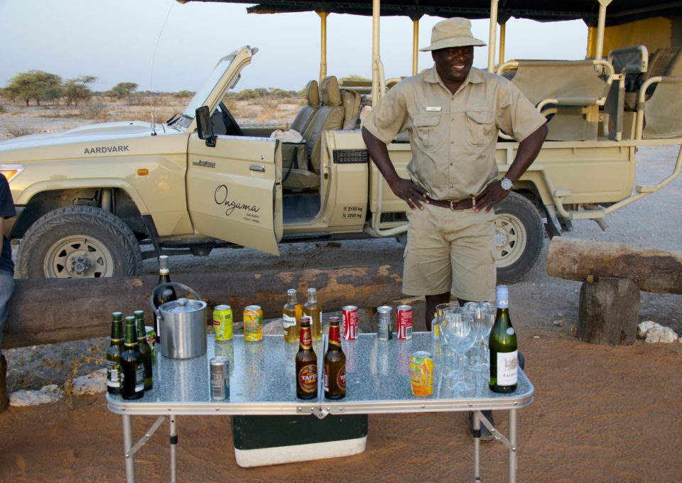
Moses, our guide, arrived in a modified Land Cruiser Series 79 truck that rattled, jiggled, squeaked, and bounced us wide awake. Warthogs trotted urgently across the 7km dust path out of the reserve and into the national park. Their tails stuck straight up in the air like porcine radio antenna, presumably communicating with other pigs as to where the tourist jeeps were headed. Moses was all smiles as he worked the rangers, shared some of our juices and waters with them and elicited laughter as he told jokes in Oshiwambo.
Moses was a hustler, all smiles and loaded questions. “When do you take your next safari? Do you have a guide yet? You want me to drive you?” He had a powerful sense of urgency in the wildlife quest and a competitiveness that came through in interactions with the other guides. He sometimes forgot to mention to the others that he’d found a rhino or a lion– a major no-no in the guide community. And he openly criticized another guide Alfred on the open-channel radio. We never met Alfred, but presume he was the older guide glaring at Moses at every waterhole.
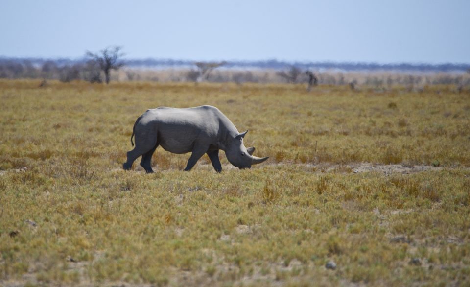
Entering through the eastern side of Etosha National Park via the Von Lindequist Gate, we followed a stock route bouncing along the network of waterholes in search of game. And we found plenty of game in Etosha. Dik-diks, with their anime eyes, sharp antlers and delicate legs, grazed cautiously every 100 meters or so along the edge of the main road. Giraffes picked at the top of thorny acacia trees. But Moses didn’t stop: no one comes to Africa to see deer. They want to see rhino, elephant, lion and cheetah.
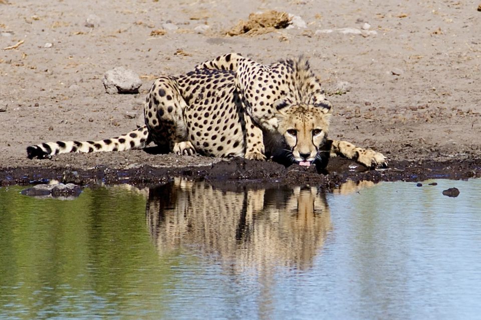
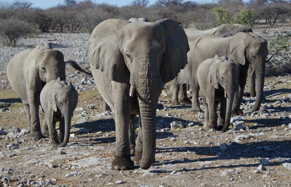
At Klein Namutoni we saw herds of zebra, giraffe, kudu and a spotted hyena. Along the southern edge of the pool, a giraffe carcass lay rotting in the dust, the beast having gotten stuck in the mud during the previous rainy season. At Klein Okevi, we waited as an enormous herd of elephants lumbered in to drink while a jackal quick-stepped between their massive legs. One of the elephants, a young male, approached our truck and flapped his ears, letting us know that he wasn’t to be trifled with. At Groot Okevi, we discovered a pride of four male lions, likely brothers, resting from a night of hunting. And at Koinachas we saw a lone cheetah (our first) drinking water while the prey of impala, kudu, eland, zebra and giraffe all watched the predator from the other side of the large pool. Only after the cheetah finished and disappeared into the bush did the rest of the animals drink.
Poaching is a scourge in southern Africa; everywhere we went in Etosha, its presence was heard in the radio communication between guides. They spoke in codes – numbers were used instead of animal names, radio channels were switched frequently and new guides chastised for sharing too much information about the location of game. The number system was used only for the highly poached animals. So elephant, rhino, cheetah, lion and leopard were all identified with numbers instead of names whereas zebras, giraffes and impalas were not. For example, “number five east of Namutoni” meant that a cheetah was crossing the dry pan basin east of the old fort, giving the guides an opportunity to shuttle their passengers over for a quick look at the elusive cat.
It took us one morning to fully decipher the code system, so I’d imagine the poachers have it figured out too.
FIGHTING THE GPS ONE LAST TIME
The drive from Etosha to Windhoek should have been a straight shot down B2, but like in so much in Namibia, it took us a lot longer. Our GPS seemed dead-set against the most direct route. The road signs were frequently obscured by rust or dust or both. It took us nine hours of mostly paved roads before we reached the outskirts of the capital. The convoluted roads and traffic rotaries spun us around the city before delivering us to our guesthouse, where a walled, video-monitored, electrified and razor-wired perimeter separated us from the rest of the town outside. It gave us the distinct impression that we were in the most dangerous part of the city.
We weren’t of course. Life in Windhoek and many parts of southern Africa finds fairly modest lifestyles hidden behind security gates and steel window guards.
After one night in “the castle,” we headed out for our flight to Botswana … assuming the GPS would deliver us to the airport.


Great creation mom and dad! Those are really cool pictures and incredible writing.